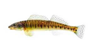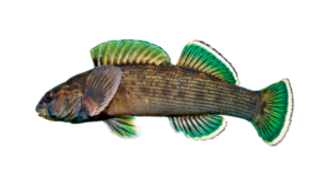
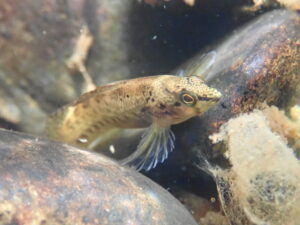
Welcome to the Blue Ridge Snorkel Trail, a series of curated snorkel sites nestled in the mountain rivers of North Carolina. Immerse yourself in the crystal clear waters and discover a vibrant underwater world teeming with brilliantly colored fishes. Whether you’re a seasoned snorkeler or a first-timer, the Blue Ridge Snorkel Trail offers an unforgettable experience that will leave you in awe of nature’s beauty.
Para español, haz clic aquí
To support the Blue Ridge Snorkel Trail please consider donating at https://www.ncworf.org/brsnorkeltrail
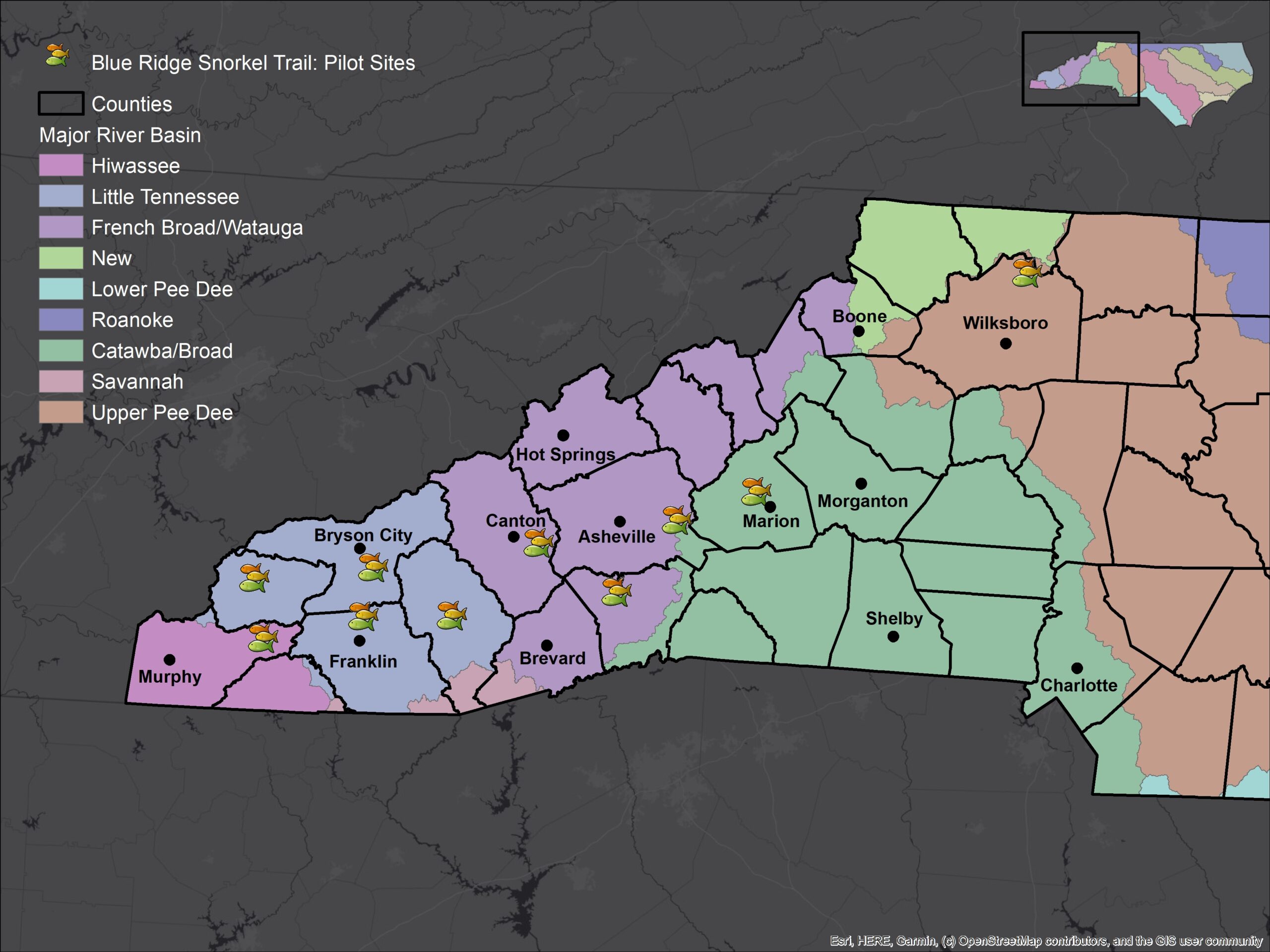

Current Locations
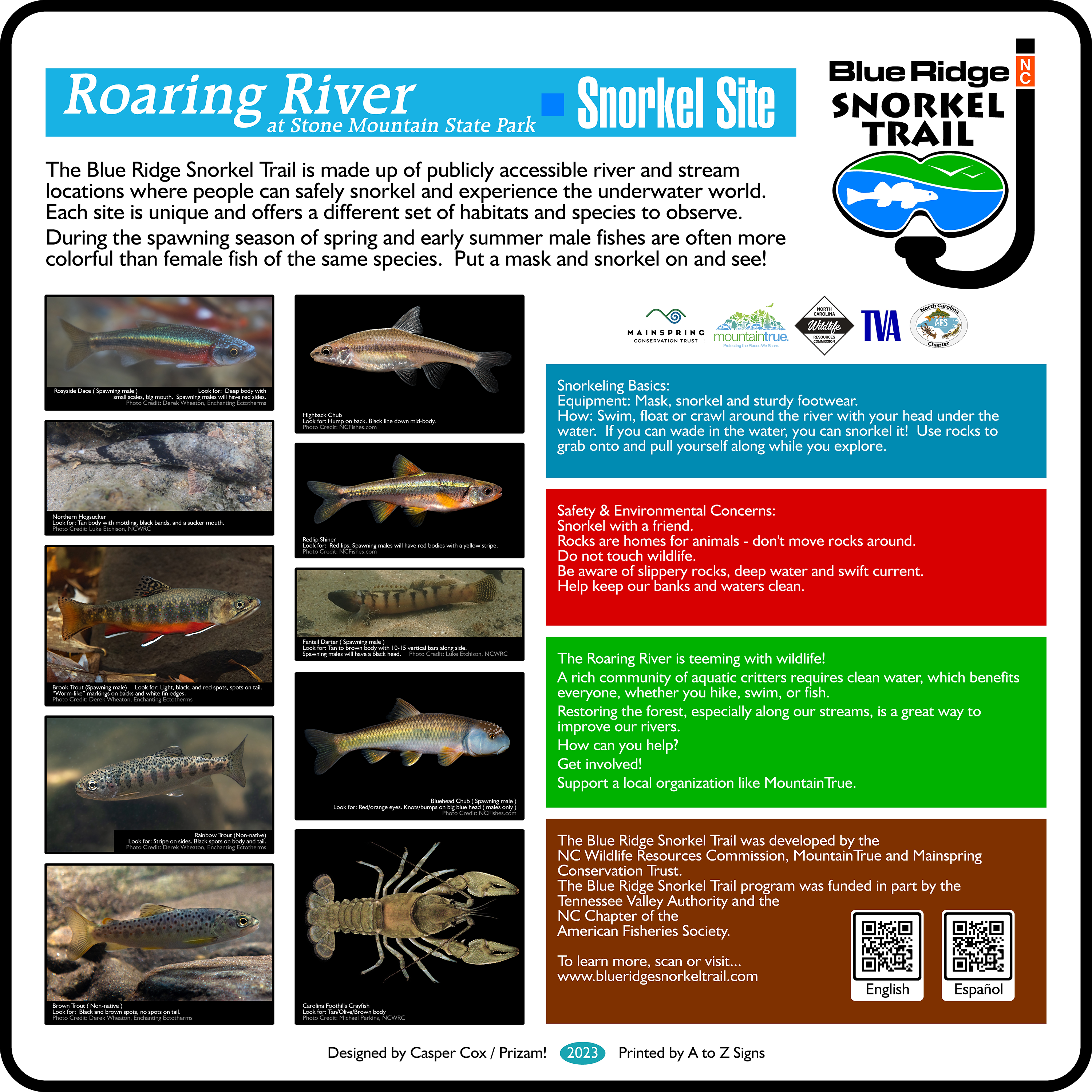
East Prong Roaring River at Stone Mountain State Park
Address: Parking lot on Stone Mountain Rd, .5 mile north of Longbottom Rd
GPS: 36.377797, -81.072654
Map: Google Maps
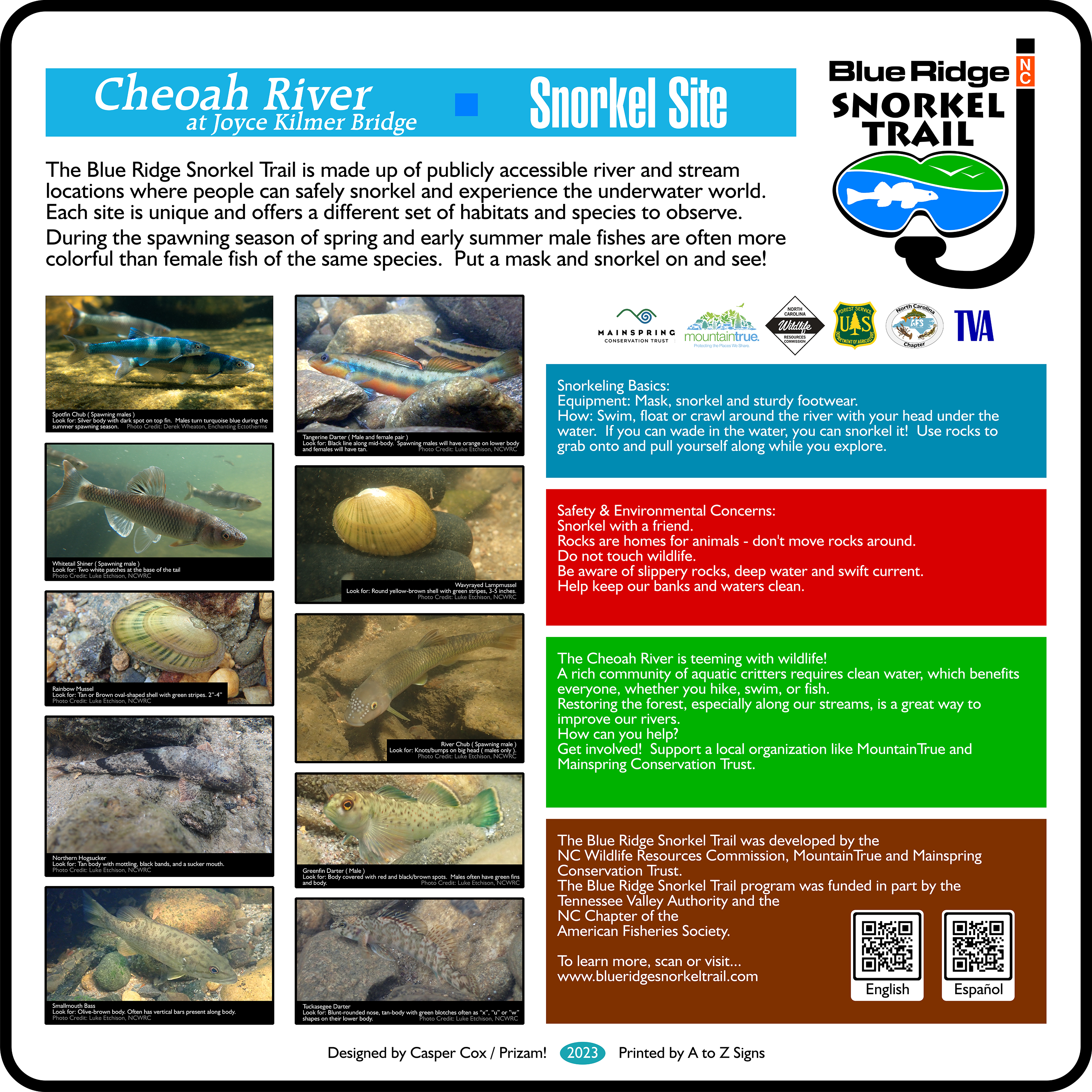
Cheoah River at Joyce Kilmer Bridge
Address: 615 County rd 1146, Robbinsville, NC 28771
GPS: 35.3812225, -83.8635322
Map: Google Maps
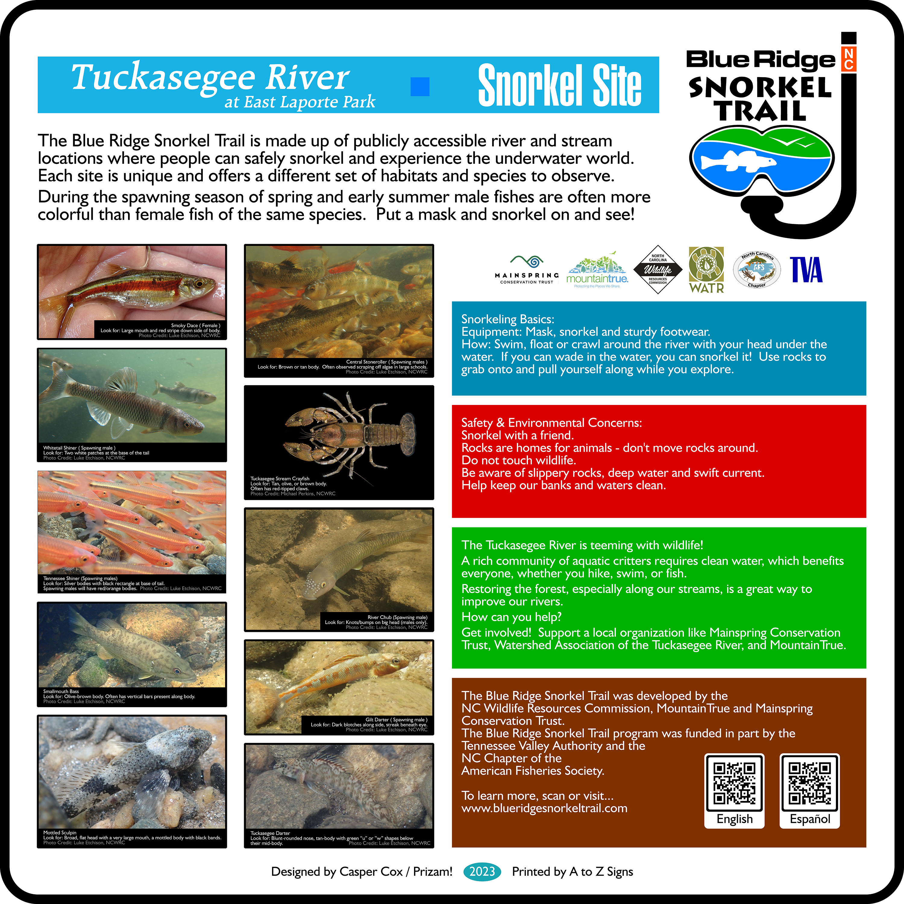
Tuckasegee River at East LaPorte Park
Address: East LaPorte River Access Park
State Route 107, Cullowhee, NC
GPS: 35.298147, -83.146837
Map: Google Maps
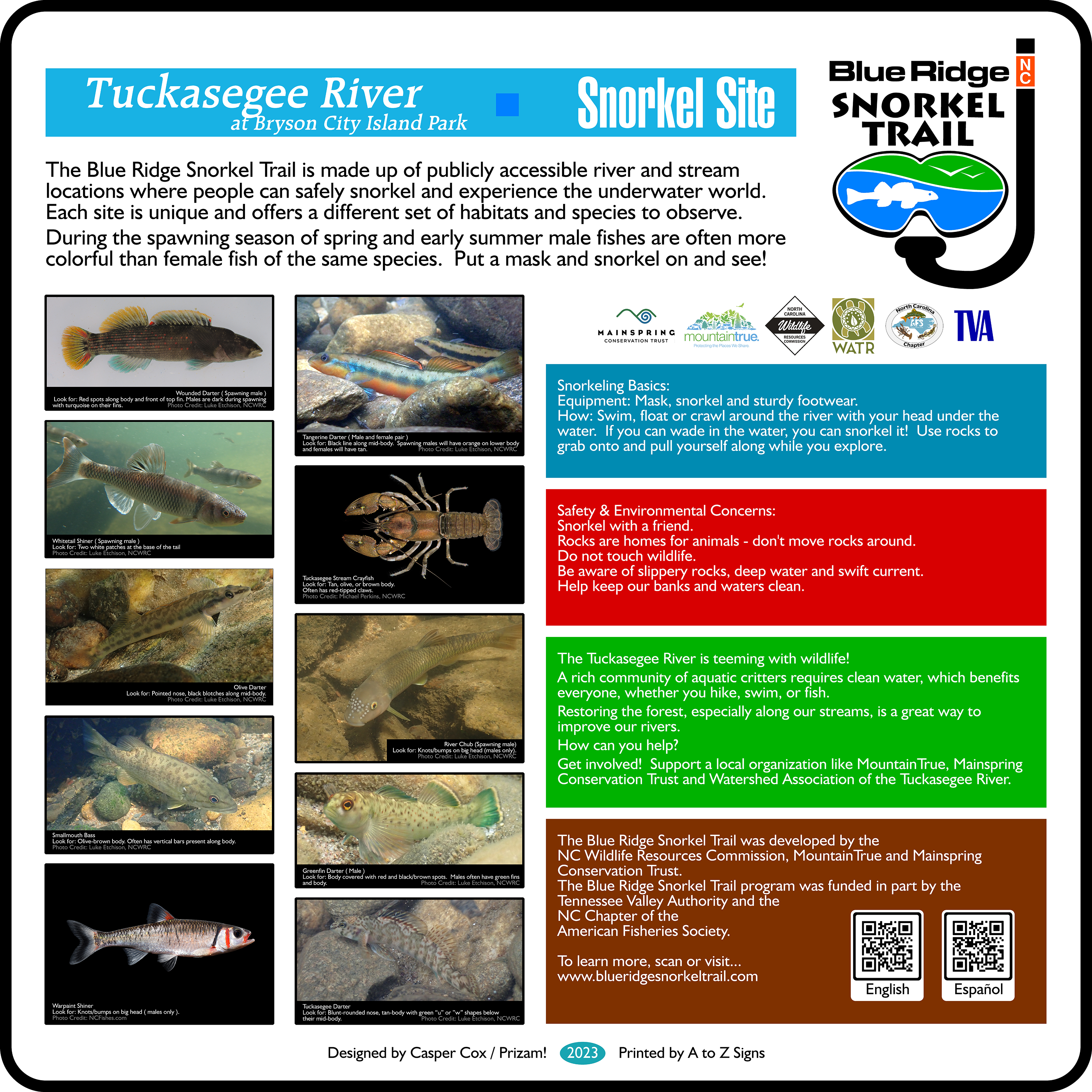
Tuckasegee River at Bryson City Island Park
Address: Bryson City Island Park, Bryson City, NC
GPS: 35.431847, -83.441869
Map: Google Maps
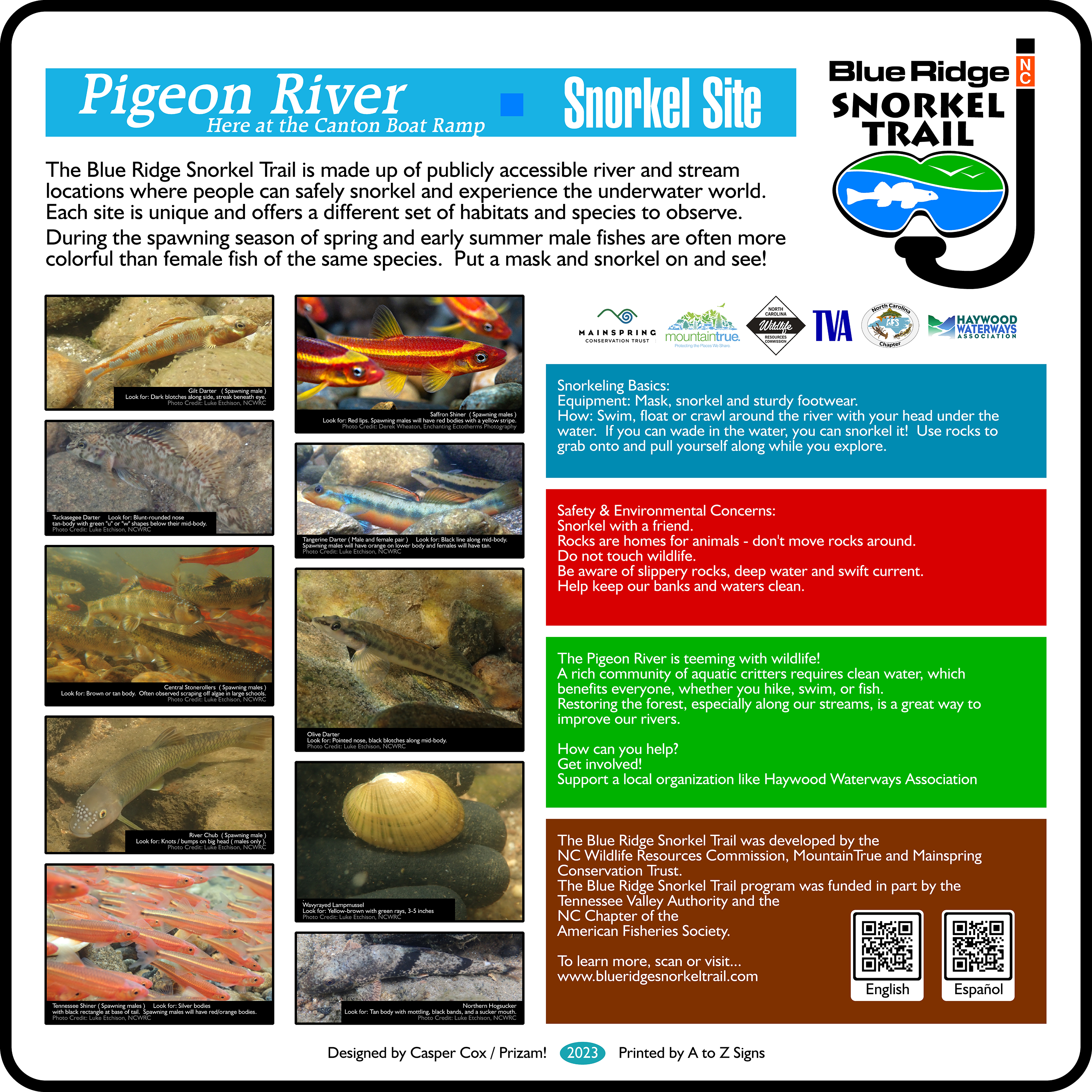
Pigeon River at the Canton Boat Ramp
Address: 77 Penland St, Canton, NC 28716
GPS: 35.525486, -82.842627
Map: Google Maps
Temporarily Closed Due to Hurricane Helene
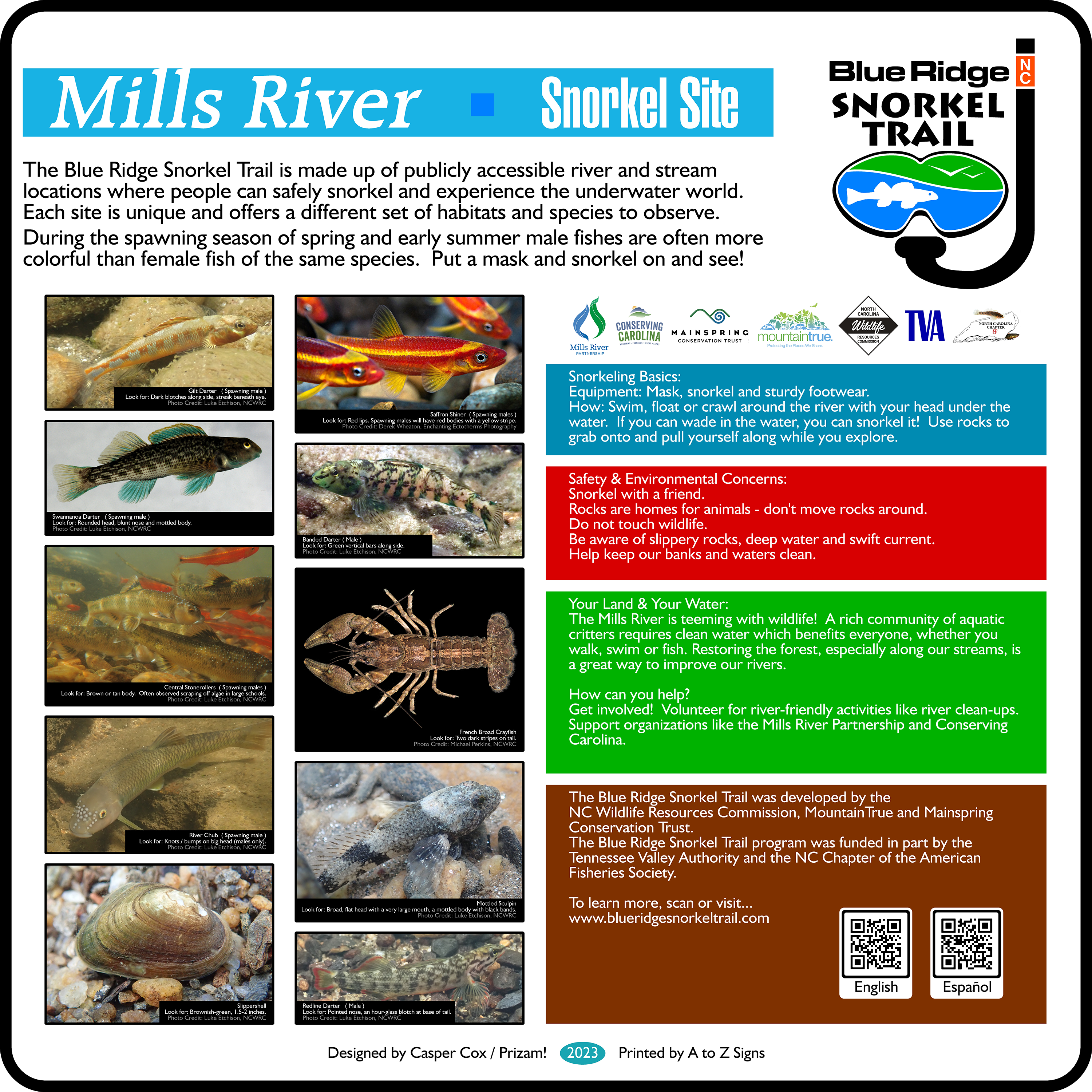
Mills River Snorkel Site
Address: River access off Hooper Ln, 124 Town Center
Dr, Mills River, NC 28759
GPS: 35.387278, -82.546667
Map: Google Maps
Temporarily Closed Due to Hurricane Helene
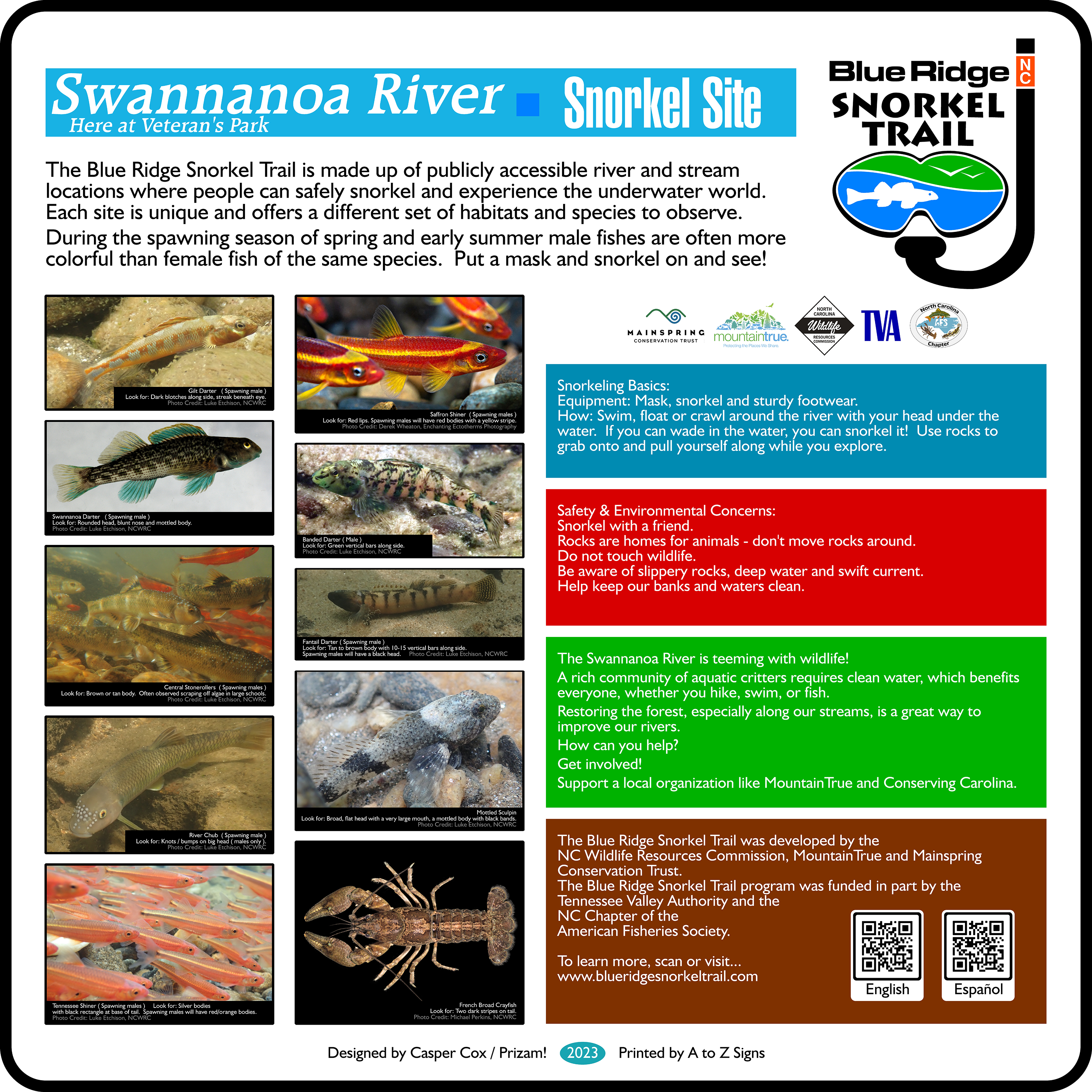
Swannanoa River at Veteran’s Park
Address: 10 Veterans Park Dr, Black Mountain, NC 28711
GPS: 35.608410, -82.337258
Map: Google Maps
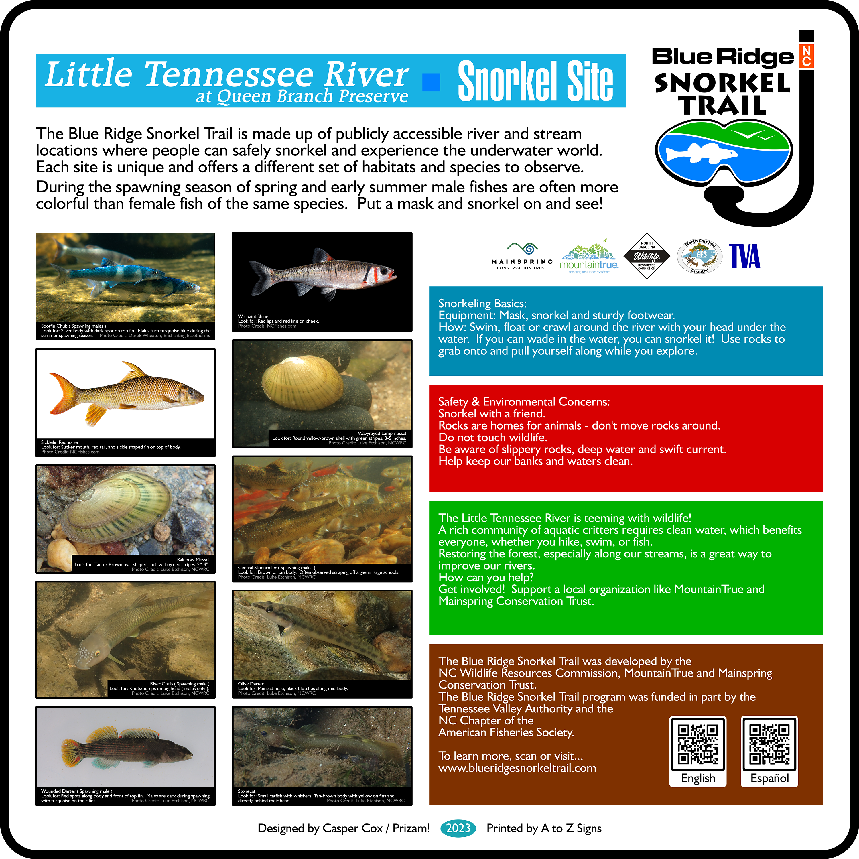
Little Tennessee River at Queen Branch Preserve
Address: 10256 Bryson City Rd, Franklin, NC 28734
GPS: 35.284664, -83.471020
Map: Google Maps
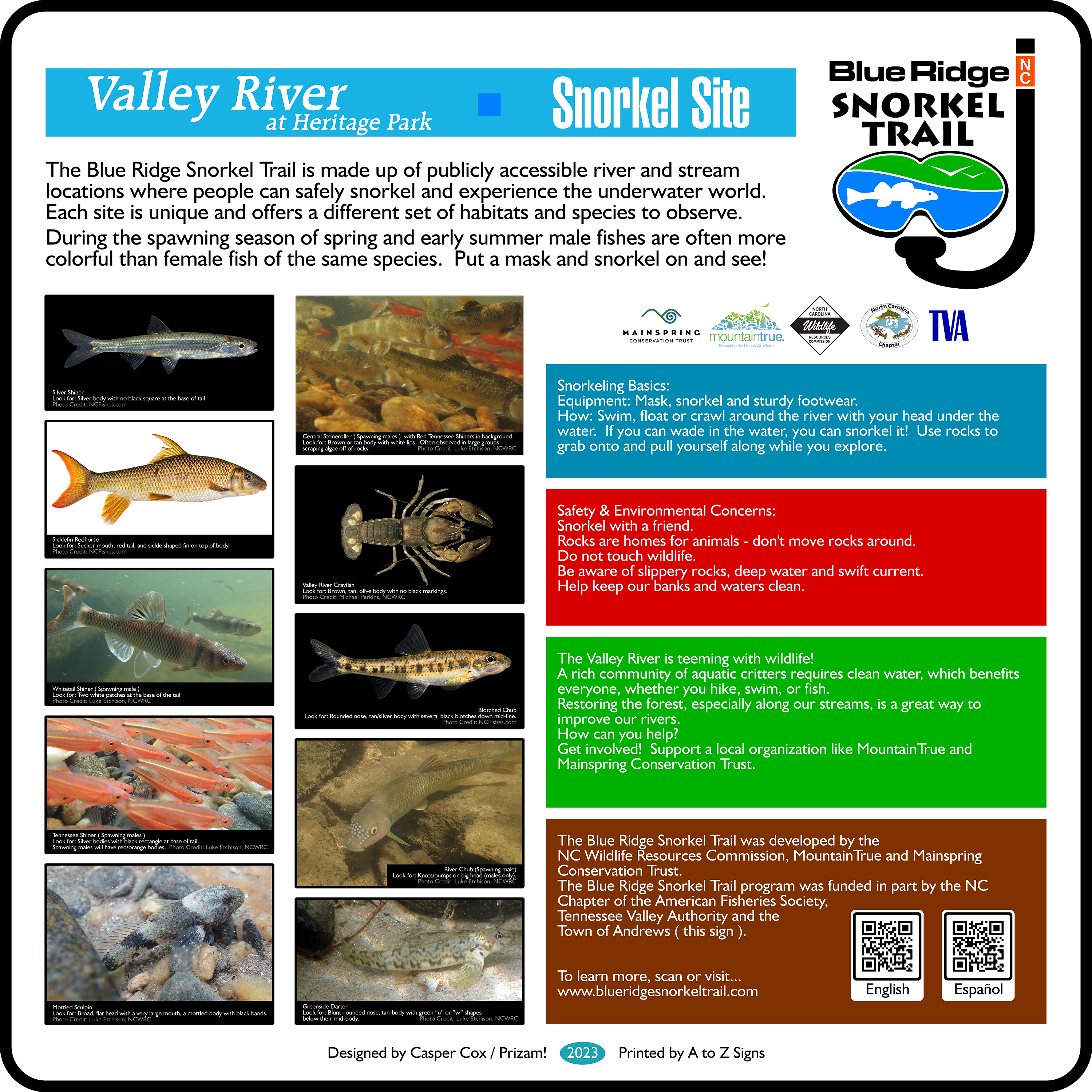
Valley River at Heritage Park
Address: Andrews, NC 28901
GPS: 35.2050000, -83.8325833
Map: Google Maps
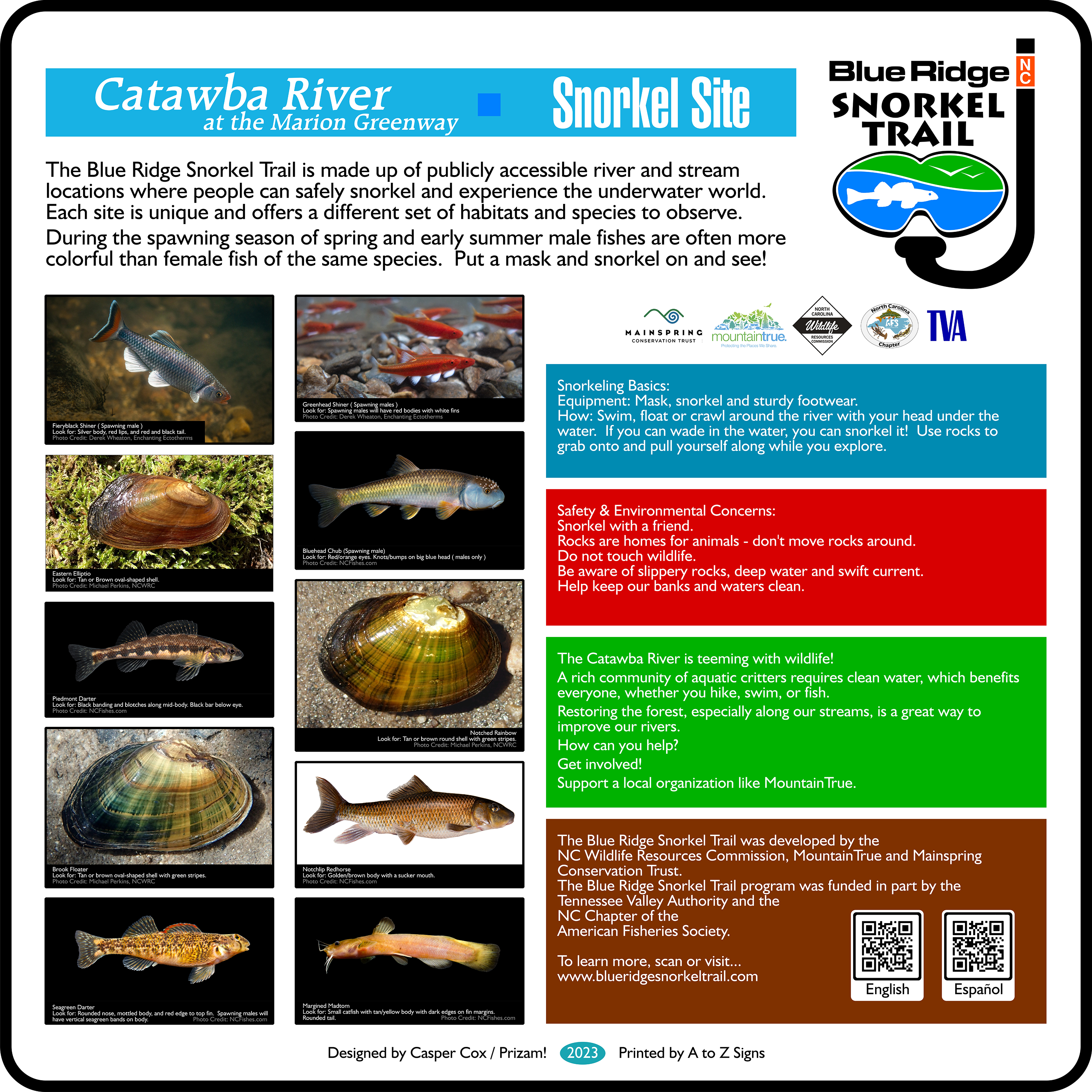
Catawba River at Marion Greenway
Address: Sam Phillips Dr, Marion, NC 28752
GPS: 35.701500, -82.046824
Map: Google Maps

French Broad River at Champion Park
Address: Old Turnpike Rd., Rosman, NC
GPS: 35.145887, -82.826496
Map: Google Maps
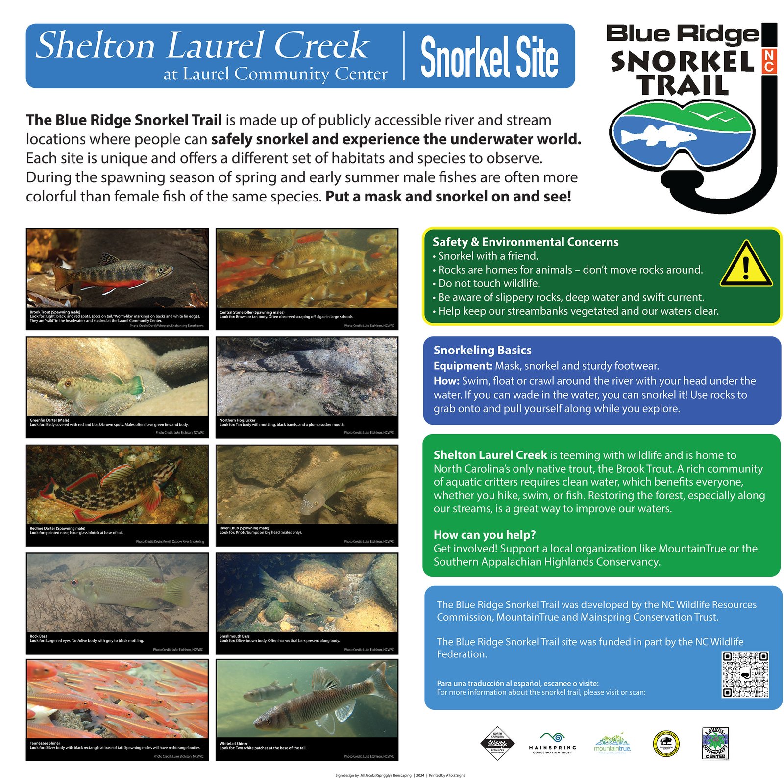
Shelton Laurel Creek at Laurel Community Center
Address: 4100 NC-212, Marshall, NC 28753
GPS: 35.954501, -82.706579
Map: Google Maps

Laurel Creek Confluence at Damascus Town Park
Address: Damascus Town Park, 202 South Beaver Dam Ave Damascus, VA 24236
GPS: 36.635083, -81.792039
Map: Google Maps
Questions?
Please contact us at: blueridgesnorkeltrail@gmail.com